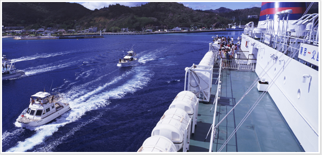
A quiet piece of Tokyo, only 1000 km (621 miles) away from the city center.
Take a boat here; there is no other way.
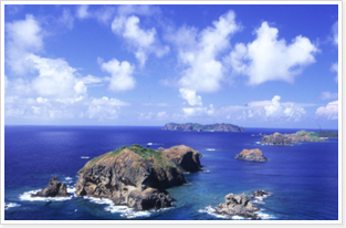
 The Ogasawara Archipelago is located about 1000 km (621 miles) south of Tokyo. The entire area is administered as single rural municipality, Ogasawara Village, which itself is a subprefecture of Tokyo. The archipelago consists of four island groups: the Mukojima (Bridegroom Island) group, the Chichijima (Father Island) group, the Hahajima (Mother Island) group, and the Volcano Islands (also known as the Iwoto, or Iwojima, group (the Sulfur Island group)). Chichijima is located at the approximate center of the archipelago and works as the hub of the village.
The archipelago comprises more than 30 islands, but only two are inhabited: Chichijima and Hahajima.
The islands do not have airports. In general, the only way to reach the islands is on the Ogasawara Maru, a liner operated by OgasawaraKaiun that makes regular runs between Tokyo and Chichijima. Once on Chichijima, you can board the Hahajima Maru for the short trip to Hahajima.
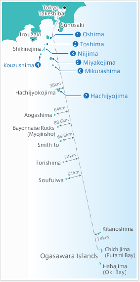
- Oshima
Area:91.1km2/Perimeter:50km/Altitude:758m(Miharayama)/Population: 8,700/From Tokyo~120km/Berthing port:Okada port or Motomachi port/【Ship】Tokyo, Atami, Ito, or Inatori - Toshima
Area:4.2km2/Perimeter:8km/Altitude:507m(Miyatsukayama)/Population: 300/From Tokyo~140km/Berthing port:Kurone or Habushiura port/【Ship】Tokyo, Shimoda
Utoneshima [Altitude 210m] is a desert island located in between Toshima and Niijima. - Niijima
Area:23.9km2/Perimeter:28km/Altitude:432m(Miyatsukayama)/Population: 2,700/From Tokyo~150km/Berthing port:Kurone or Habushiura port/【Ship】Tokyo, Shimoda/
Shikinejima Area::4km2/Perimeter:12km/Altitude:105m(Kanbikiyama)/Population: 600/Niijima~5km/Berthing port:Ashitsuki, Nobushi Port/【Ship】Tokyo, Shimoda - Kouzushima
Area:18.6km2/Perimeter:22km/Altitude:574m(Tenjyozan)/Population: 2,500/From Tokyo~175km/Berthing port:Maehama or Takowan/【Ship】Tokyo, Shimoda - Miyakejima
Area:55.5km2/Perimeter:35km/Altitude:815m(Oyama)/Population: 2,800/From Tokyo~180km/Berthing port:Miike, Sabigahama port/【Ship】Tokyo - Mikurashima
Area:20.6km2/Perimeter:16km/Altitude:851m(Oyama)/Population: 280/Miyakejima~18km/Berthing port:Mikura port/【Ship】Tokyo - Hachijojima
Area:69.5km2/Perimeter:59.5km/Altitude:854m(Hachijyofuji)/Population: 8,200/From Tokyo~290km/Berthing port:Sokodo port or Yaene port/【Ship】Tokyo/
Aogashima Area::6km2/Perimeter:9km/Altitude:423m(Otonbu)/Population: 200/Hachijyojima~67km/Berthing port:Sanpo port/【Ship】Hachijojima

 Chichijima, located at 27°5' north latitude and 142°11' east longitude, has an area of 23.8 km2 (9.2 sq. mi.), and is just about twice the size of Tokyo's Chiyoda ward. The boat trip from Tokyo's Takeshiba pier to the island's Futami port takes about 25½ hours.
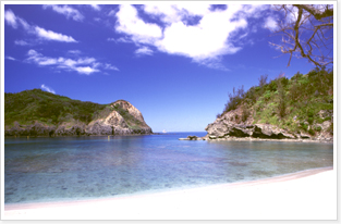 Hahajima is located at 26°38' north latitude and 142°9' east longitude, about 50 km (31 miles) south of Chichijima. With an area of 20.21 km2 (7.8 sq. mi.), it is about the same size as Tokyo's Kita ward. The Hahajima Maru makes the trip here from Futami port in about 2 hours.
Subtropical climate, and abundance of fascinating plant and animal life forms.
The "Galapagos of the East."
Because these islands are in the subtropics, temperatures stay within a relatively narrow band year-round. The low for the year is about 15°C (59°F), the high is about 32°C (90°F), and the yearly average is 23°C (73.4°F), A much more easygoing climate than on the mainland, where temperatures fall well below freezing in winter and climb above 32°C (90°F) in the summer.
| Average Monthly Highs and Lows (°C) | ||||||||||||
|---|---|---|---|---|---|---|---|---|---|---|---|---|
| Average over last 5 years | Jan. | Feb. | Mar. | Apr. | May. | Jun. | Jul. | Aug. | Sep. | Oct. | Nov. | Dec. |
| High (°C) | 20.8 | 20.9 | 21.5 | 22.8 | 25.4 | 28.2 | 30.5 | 30.5 | 30.1 | 28.7 | 26.1 | 22.6 |
| Low (°C) | 15.9 | 15.8 | 16.5 | 18.2 | 21.1 | 23.8 | 25.6 | 26.1 | 25.8 | 24.3 | 21.8 | 17.9 |
| Precipitation (mm) | 75.9 | 68.1 | 85.8 | 126.6 | 157.3 | 131.2 | 74.0 | 77.9 | 154.0 | 176.0 | 106.8 | 118.2 |
| Average water temperature (°C) | 21.0 | 19.9 | 21.5 | 21.0 | 21.9 | 23.6 | 28.5 | 29.1 | 27.4 | 26.8 | 25.3 | 23.0 |
 Chinese fan palms, pandanus trees, and ferns grow in abundance, and the towns are full of flowering hibiscuses and bougainvillea. You can also see wild bananas, oranges, papayas, Chinese banyans, and palm trees.
The islands are home to a large variety of indigenous animal species, many designated as national treasures. Here you can see Bonin fruit bats, Bonin white-eyes (a bird found only on Hahajima), Japanese wood pigeons, and Ogasawara buzzards.
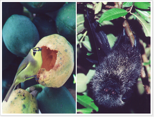 See fascinating endemic insects such as the Ogasawara Celastrina butterfly, and the Boninthemis insularis and Hemicordulia ogasawarensis dragonflies. Also encounter interesting land snails (Zonitoides arboreus and Bekkochlamys perfragilis), Cellana sea snails, and terrestrial hermit crabs.
Beautiful night skies are full of stars not visible from the higher latitudes of the Japanese mainland. Many astronomy buffs make the trip here to get a clearer view of Halley's comet, and solar and lunar eclipses. The upper part of the Southern Cross constellation can be seen from the islands at certain times of the year.
Dolphins, whales, sea turtles… The clear waters are a paradise for sea life.
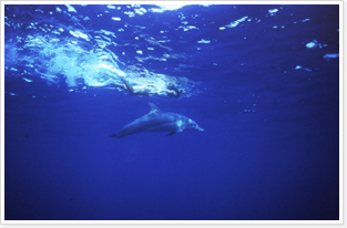 The beautiful sea around the islands is teeming with life. You can see dolphins all year round. Watch as the friendly spinner and Indo-Pacific bottleneck dolphins swim and jump alongside your boat.
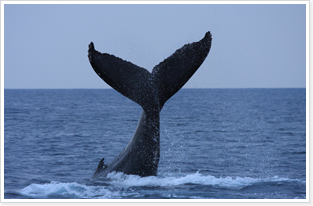 Whale watching is seasonal: different whales at different times. Your chances of spotting some humpback whales are quite high from January through mid-April, while they stay close to shore to bear and raise their calves. With a little luck you may see parents and children together. From May through autumn, sperm whales-easily identified by their enormous square heads-are often seen in waters off the coast.
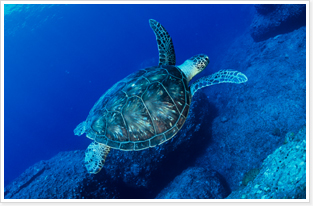 And perhaps you will meet up with some big green turtles, since the Ogasawara shores are their favorite spawning grounds. A protected spawning area has been set aside for them in Hahajima's Wakihama Nagisa park. Chichijima's Ogasawara Marine Center, near Seihyo Beach, also participates in turtle protection.
Mr. Ogasawara: The Man Who Discovered the Islands.
| 1593 (Bunroku 2) |
According to tradition, this is the year that Sadoyori Ogasawara discovers the islands. Sadoyori, it is said, is the grandson of Nagatoki Ogasawara, the lord of Shinshu Fukashi castle in the present-day city of Matsumoto. |
|---|---|
| 1830 | The first settlers reach the islands, as Europeans, Americans, and Hawaiians disembark at the inviting natural harbor-today's Futami port-at Chichijima. |
| 1853 | Commodore Matthew Perry, in command of the East India Squadron, stops at the harbor on his way from Okinawa to Japan. Activity in the area increases, and in 1861 the shogunate sends the steam-powered warship Kanrin Maru on an expedition to the islands, lead by foreign affairs commissioner Tadanori Mizuno. He successfully makes an appeal to the residents that the islands are Japanese territory, and the existing inhabitants are under protection. |
| 1876 (Meiji 9) |
The islands are internationally recognized as Japanese territory, and are placed under the jurisdiction of the Department of the Interior. In 1880, jurisdiction is transferred to the Tokyo administration. |
| 1927 (Shōwa 2) |
The Shōwa Emperor, new to the throne, makes an Imperial visit to Chichijima and Hahajimi, traveling on the battleship Yamashiro. Monuments commemorating the visit still stand. In 1946 (Shōwa 19), as the war intensifies, 6,886 inhabitants of the Ogasawaras are forcibly evacuated to the mainland, while some residents remain as civilian workers for the army. |
| 1945 (Shōwa 20) |
The Battle of Iwo Jima (from February to March) kills close to 27,000 soldiers. |
| 1946 (Shōwa 21) |
The U.S. armed forces take jurisdiction of the Ogasawaras, and former non-Japanese inhabitants (of American and European descent) are allowed to return. After intensive negotiations, an agreement to return the islands to Japan is sealed in April 1968 (Shōwa 43), and the Japanese regain jurisdiction on June 26. |
| 1972 (Shōwa 47) |
The archipelago becomes the Ogasawara National Park, in appreciation of its natural beauty. |
The main industry here is…tourism!
A cordial welcome awaits you.
 Population on the islands peaked at 7,711 just before the start of World War II. Today's population (as of April 1, 2009) is 2,387. The islands have a Village administration office, a Tokyo Metropolitan Government satellite office. a police force, locally administered public elementary and junior high schools, and a Tokyo-administered high school. Stores, amply stocked with all daily requirements, are concentrated near the ports.
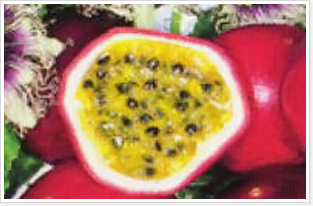
 The main industries here are agriculture, fishing, and tourism. Tomatoes and other vegetables, flowers, passion fruit, and tropical fruit trees thrive in the subtropical climate. Locally caught yellow jack (shima aji), red sea bream (madai), and yellowtail (kanpachi) are consumed on the islands and shipped via the Ogasawara Maru to the mainland.
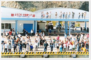
People on the islands warmly welcome visitors who have made the long trip. All of us here-not just the staff at hotels and tourist services, but also the shopkeepers and the people in the street-are eager to make your stay here as enjoyable as it can be. And, when your visit is done, many will turn out to give you a warm sendoff, waving from the shore and escorting you with their boats, inviting you back.
